Daily Life & Culture
How Did the Vikings Navigate? Sunstone and Stars
No compass, no map, thousands of miles of open Atlantic: how Vikings navigated by sun, sunstone, stars, and wave patterns - sagas, finds, and physics.
Contents
- No Compass, No Problem: Dead Reckoning and Hard-Won Experience
- The Sunstone: What the Sagas Say
- What Scientists Actually Proved - and What They Didn’t
- The Uunartoq Sun Compass
- Stars, Waves, and Birds: The Full Navigation System
- Experimental Archaeology: Replicas on the Open Sea
- A Feat That Still Impresses Today
How do you find your way across a thousand miles of open Atlantic with no compass, no sextant, and often no glimpse of the sun for days on end? The Vikings did exactly that - sailing from Norway to Iceland, from Iceland to Greenland, and eventually all the way to Newfoundland, centuries before magnetic compasses became common in northern Europe. Exactly how they pulled it off is still debated, but between Icelandic sagas, archaeological finds, and modern physics, a remarkably detailed picture has emerged.
No Compass, No Problem: Dead Reckoning and Hard-Won Experience
The backbone of every Viking voyage was what modern sailors call dead reckoning: knowing the rough heading, estimating distance traveled from elapsed time and speed, and correcting course using landmarks, distant cloud formations over unseen coastlines, or telltale ocean currents. Experienced helmsmen passed this knowledge down orally across generations - there were no fixed bearings, only an enormous accumulated memory for sky, sea, and wind.
A fixed mental framework helped here: the Old Norse áttir system, which divided the horizon into eight broad directions anchored to characteristic sun positions at specific times of day and year, rather than to a fixed magnetic north. “North” meant something slightly different to a sailor in Trondheim than to one in Iceland, because directional references were tied closely to local sky observation. That flexibility looks imprecise by modern standards, but it was entirely sufficient in practice, because it matched the sailors’ actual observational knowledge instead of forcing an abstract grid onto the sky.
Especially important on top of that was so-called latitude sailing: holding a specific northern latitude and running due west until you hit your destination, a technique that required no precise way of fixing longitude, just a reliable way of holding your latitude. This is exactly where the sun and stars come in.
The Sunstone: What the Sagas Say
The 13th-century Icelandic tale Rauðúlfs þáttr describes King Olaf holding a so-called sólarsteinn (sunstone) up to an overcast sky to pinpoint the sun’s exact position even though it was hidden behind clouds. A similar reference appears in the Hrafns saga Sveinbjarnarsonar. These passages are the origin of a theory that has occupied researchers for decades: did the Vikings use birefringent crystals like calcite - known in Iceland to this day as “silfurberg” - to reveal the sun’s position through polarized skylight, even under thick cloud cover?
Physically, the idea holds up. Calcite splits light into two beams whose relative brightness shifts depending on the polarization angle of the sky. Rotate such a crystal in front of the eye, and you can find the point where both beams match in intensity - a point that roughly indicates the sun’s direction, even when it’s hidden behind clouds or just below the horizon.
“He had the sun found through the sunstone though the sky was overcast, and it appeared exactly where he had said it would be.” - paraphrased from the tradition preserved in Rauðúlfs þáttr
What Scientists Actually Proved - and What They Didn’t
In 2011, French physicists led by Guy Ropars at the University of Rennes published a widely noted study in Proceedings of the Royal Society A, demonstrating experimentally that a calcite crystal can locate the sun’s position to within a few degrees, even under overcast skies or shortly after sunset. In 2013, the same research group made headlines again when they identified a calcite crystal in the wreck of a 16th-century English warship off Alderney in the Channel Islands - evidence that the technique may have remained in use long after the Viking Age ended.
What often gets lost in this discussion: a sunstone conclusively dated to the Viking Age itself has never been found. The entire sunstone theory rests on two saga passages, plausible physics, and the later Alderney find - a compelling circumstantial case, but not archaeological proof from the 9th to 11th centuries. Serious scholarship still treats the sunstone as a plausible but unproven hypothesis, not an established fact.
The Uunartoq Sun Compass
A different find rests on firmer ground. In 1948, archaeologists discovered a roughly semicircular wooden fragment with incised lines in Uunartoq Fjord in southern Greenland, dated to around the year 1000. Danish archaeologist C. L. Vebæk interpreted it as the remains of a sun compass, a so-called sólskuggafjöl (sun-shadow board): a central pin cast a shadow onto engraved curves, from which north-south direction could be read off at specific times of day.
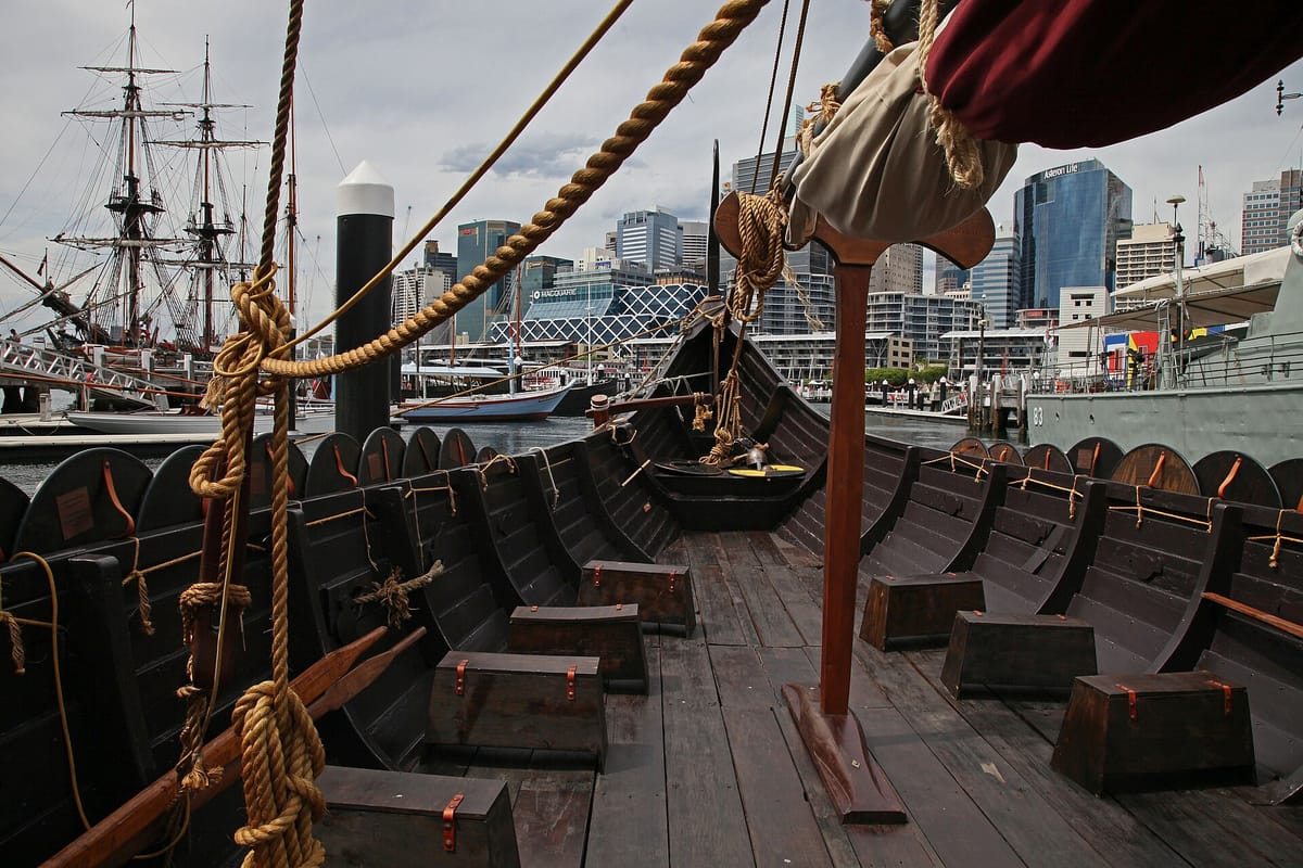 Image credit: JC Merriman (CC BY 2.0), via Wikimedia Commons
Reconstructions of this instrument genuinely work, accurate to within a few degrees - provided the user already has a rough sense of the season and their own latitude, which experienced sailors presumably did. Still, the Uunartoq fragment is a single object, and its exact function remains debated in the scholarly literature to this day.
Listen to Wellerman while you read on, a rough-edged sea shanty that captures the mood of a seafaring nation:
Stars, Waves, and Birds: The Full Navigation System
Sunstone and sun compass were probably just two tools in a much larger repertoire. At night, sailors oriented themselves by the North Star and familiar constellations, whose rising and setting points on the horizon served as rough directional markers. Experienced helmsmen also read wave patterns: a persistent ground swell from a given direction often held steady over long distances and served as a kind of “water road,” clearly distinguishable from local wind chop.
Water color, temperature, and even the smell of the air counted as reliable clues too: experienced sailors could often sense the nearness of land from a changed swell pattern or drifting seaweed long before any coastline appeared on the horizon. Wildlife helped too - land birds spotted far out at sea signaled nearby coastlines. The Landnámabók, Iceland’s medieval book of settlements, records that the settler Flóki Vilgerðarson deliberately carried ravens aboard and released them to follow their flight toward land - a method that echoes the biblical story of Noah’s Ark closely enough that historians disagree on how literally to take it, though it keeps surfacing as a plausible practice among experienced seafarers.
| Method | Principle | Evidence Status |
|---|---|---|
| Dead reckoning | Estimating course, time, speed | Well-supported historically |
| Latitude sailing | Holding a fixed northern latitude | Well-supported historically |
| Sun compass (Uunartoq) | Shadow cast on a marked scale | One find, archaeologically confirmed |
| Sunstone (calcite) | Polarized light under cloud cover | Sagas + physics, no Viking-age find |
| Stars & wave patterns | Reading the sky and swell | Experiential knowledge, plausible |
| Bird release | Releasing land birds, following flight | Landnámabók, debated |
Experimental Archaeology: Replicas on the Open Sea
Perhaps the most convincing evidence that these methods actually worked comes from modern replica voyages. In 2007 and 2008, the Havhingsten fra Glendalough (“Sea Stallion from Glendalough”), a faithful reconstruction of the Skuldelev 2 longship housed at the Viking Ship Museum in Roskilde, sailed from Denmark to Dublin and back - a multi-week voyage along the British and Irish coasts during which the crew deliberately avoided modern navigation equipment and relied on historical methods instead. The voyage confirmed that dead reckoning, coastal bearings, and sky observation, in experienced hands, were genuinely enough to steer a 30-meter ship safely across open water.
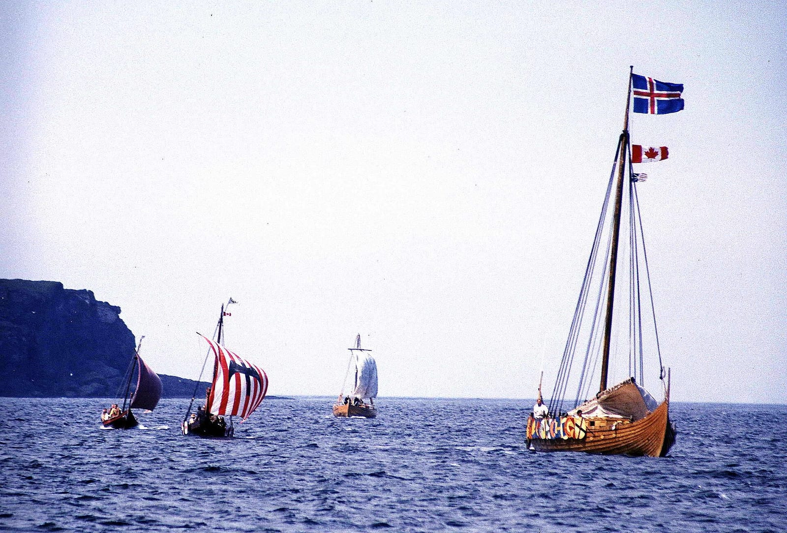
An even more ambitious test came from the Icelandic replica ship Íslendingur, which in the year 2000 - marking the 1000th anniversary of Leif Erikson’s discovery of America - sailed from Iceland via Greenland to Newfoundland and on to New York. Here too, the crew relied primarily on traditional techniques, backed up by modern safety equipment for emergencies only. Voyages like these aren’t archaeological proof in the strict sense, but they demonstrate something very concrete: what the sagas describe isn’t legend, it’s seamanship that actually works, provided you have years of hard-won experience reading wind, waves, and sky.
A Feat That Still Impresses Today
What the Vikings achieved navigationally is all the more remarkable given they did it aboard open, relatively low-sided ships like the famous longship, which offered little shelter from wind and spray. That seafarers under these conditions reliably reached and relocated Iceland, Greenland, and eventually Newfoundland speaks to a navigation system built not on a single miracle instrument, but on an impressive combination of observation, experience, and clever aids.
Anyone who grew up with a GPS dot on their phone screen can easily underestimate how much mental effort each of these methods actually demanded. Misjudging the sun’s position, missing a telltale band of cloud on the horizon, or misreading a wave pattern could mean the difference between life and death in the middle of the North Atlantic, hundreds of kilometers from the nearest coast. That Viking ships nonetheless traveled reliably between Norway, Iceland, and Greenland speaks less to any single brilliant tool than to an unusually disciplined observational system passed down across generations.
Our take: the sunstone is the most fascinating of these methods, and also the least proven - a case where solid physics and old sagas line up nicely without archaeology yet delivering the final proof. The Vikings’ actual navigational achievement likely lay in the sum of all the techniques described here rather than in any single trick. If you’re curious about the ships that made these voyages possible in the first place, our article on the raid on Lindisfarne shows just how quickly this navigational skill turned into a feared weapon.