Warriors & Battles
The Danevirke: The Wall That Guarded Denmark
The Danevirke wall in Schleswig: how it sealed Denmark's southern approach, what excavation reveals about its building phases, and why it fell in 1864.

Contents
- What the Danevirke Actually Is
- 808 in the Frankish Annals, and the Awkward Question of Age
- Hedeby, the Portage, and Why a Rampart Is a Business Model
- Myth and Fact Around the Danevirke Wall
- Valdemar’s Wall: Brick as a Statement
- From 808 to UNESCO: A Line Reused Across the Centuries
- Conclusion: A Border You Can Walk Along
Walk across a low grassy ridge near the village of Dannewerk in northern Germany and you are walking over one of the largest structures early northern Europe ever produced. The Danevirke is not a single wall. It is a system of earthen ramparts, ditches, palisades, brickwork and even barriers driven into open water, strung across the Schleswig isthmus for roughly thirty kilometres from the Schlei inlet in the east to the rivers and wetlands in the west. For centuries it closed the land approach to Denmark from the south, and most of it is still there for anyone who knows what to look for. That is the awkward part. After a thousand years an earthen rampart looks like any other slope in a field, and people stroll over it without registering that they have just crossed what was once the most consequential border in the North.
What the Danevirke Actually Is
The map does most of the explaining. Jutland narrows southwards into an isthmus. The Schlei cuts deep inland from the Baltic side, while the Treene, the Eider and a spread of wet lowland close off the west. Between them lies a dry corridor, and through it ran the most important overland route in the North, the road later known as the Ox Road, in Danish the Hærvejen or army road. Block the corridor and you control land access to Jutland. That is not a clever conclusion reached by modern historians. Any Iron Age traveller could work it out on foot.
The Danevirke exploits that geography with real discipline. Where the ground is dry, there is a rampart. Where water or bog already makes movement impossible, nobody bothered digging and the landscape does the work. The result is not a line so much as a chain of sections built at different times, repeatedly raised, extended and joined to one another. It is a building programme spanning many generations, not a single project with a start and a finish.
The components are worth setting out, because the list tells you more than any summary:
| Element | Position and construction | What it reveals |
|---|---|---|
| Main wall | The core barrier across the isthmus, raised and reinforced repeatedly | Carries the oldest phases and the earliest dating evidence |
| North, east and curved walls | Forward and flanking sections of varying length | The barrier grew in stages, not in one campaign |
| Kovirke | A dead straight line south of Hedeby with a sharply cut ditch | Straightness argues for central planning; the date stays contested |
| Connecting wall | Links the main wall to the rampart at Hedeby | Market and frontier were welded into one system |
| Semicircular rampart at Hedeby | An arc enclosing the town on the Haddeby Noor | The market sits inside the defences, not outside |
| Valdemar’s Wall | A 12th century brick wall on top of the main rampart | A technological jump: fired brick, not earth and timber |
| Underwater barrier, Haddeby Noor | Rows of driven piles in shallow water | The defence did not stop at the shoreline |
808 in the Frankish Annals, and the Awkward Question of Age
The most famous written notice appears in the Royal Frankish Annals under the year 808. The Danish king Godfred, it records, had a rampart raised along the Saxon frontier reaching from the eastern sea to the western, pierced by a single gate through which carts and riders could pass. It is a dry administrative entry, and quietly remarkable, because it documents a large northern building project from the perspective of the people on the other side of it. The same source reports that Godfred destroyed the Slavic trading settlement of Reric and moved its merchants to the Schlei, into the area that became Hedeby. Wall and market belong together from the first mention.
Archaeology has since moved the picture. Dendrochronological work, dating derived from the growth rings of timber built into the structure, places the oldest phases of the main wall well before Godfred, back into the 8th century. He was not the inventor of the Danevirke but the ruler who enlarged an existing barrier and framed it in terms the Franks would understand. The stretch tying the main wall to the rampart at Hedeby yields much later dates, pointing to the late 10th century and the reign of Harald Bluetooth.
Which means the obvious question, who built it, is the wrong question. There is no builder. There is a sequence of rulers who kept reusing the same line for their own purposes, and the layers in the rampart are the receipt.
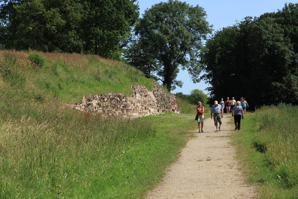
Image credit: Frank Vincentz (CC BY-SA 3.0), via Wikimedia Commons
Something from the same world to listen to while walking the line:
Hedeby, the Portage, and Why a Rampart Is a Business Model
A frontier wall reads as a defensive work, and with the Danevirke that is only half true. The more interesting half gets left out. Sitting directly against the barrier is Hedeby, the largest trading place in the Viking Age North, and the two sites explain one another.
The reason is logistics. A merchant moving goods from the Baltic to the North Sea could sail the whole Jutland peninsula, round Skagen and through the Skagerrak, a long haul and a nasty one in poor weather. Or he could run up the Schlei to Hedeby, unload, and have the cargo carried the short distance overland to the Treene at Hollingstedt, from where the Eider opened onto the North Sea. That shortcut was worth a great deal, and it only worked because somebody controlled the isthmus. Controlling the isthmus is precisely what the Danevirke does.
That turns the wall into something other than a barricade. It channels movement. Where a single gate stands open, every ox cart goes through it, and whoever holds the gate can count, inspect and charge. A thirty kilometre earthwork will not stop a determined army indefinitely, and everyone involved knew it. What it does is force traffic into predictable paths, and predictability is the precondition of rule. The commercial half of the story is in our article on Hedeby.
Our editorial team would argue this is the genuinely underrated thing about the site. It gets narrated as a military bulwark because that makes the better story. The sober reading is different: an emerging kingdom built a customs barrier on a national scale and accepted that it could be overrun in an emergency. That is not a contradiction, it is arithmetic. The wall works every day of the year. The attack comes perhaps once in a generation.
Myth and Fact Around the Danevirke Wall
Few monuments in the North are as thoroughly grown over with legend as this one. Danish tradition has attributed the Danevirke since the Middle Ages to Queen Thyra, wife of Gorm the Old and mother of Harald Bluetooth. She appears in Saxo Grammaticus as the one who threw up the wall against the south, and she carries the byname Danebod, roughly Denmark’s adornment. On the smaller of the two Jelling runestones, Gorm does name his wife with a formula pointing in that direction. It is worth separating the legend from the evidence.
Myth: Queen Thyra built the Danevirke. Fact: The earliest rampart phases are more than two centuries older than her lifetime. The attribution converted an honorific on a runestone into a building programme. The stones are covered in our article on the Jelling stones.
Myth: It was the Viking wall against Charlemagne. Fact: The expansion of 808 really was aimed at the Frankish empire, but the barrier had stood for decades. It is a permanent institution, not a reaction to one enemy.
Myth: A wall of this length was meant to repel attacks. Fact: It directs traffic, secures revenue and marks a border. Defence is one purpose among several, and in a crisis the least reliable.
The saga literature knows the site too. Snorri Sturluson mentions the Danavirki in the saga of Olaf Tryggvason in Heimskringla, in the context of holding off an imperial attack on Denmark, and Adam of Bremen describes the fortification on the Danish frontier in the 11th century. This was never a forgotten heap of soil.
Valdemar’s Wall: Brick as a Statement
In the 12th century the rampart acquired a crown that changed its character. Under King Valdemar the Great a wall of fired brick was raised along the main rampart, several kilometres long and several metres high. It counts among the earliest monumental brick structures anywhere in the North, and stretches of it still lie exposed in the field.
The leap is larger than it looks. Earth and timber are materials any sizeable community can move. Brick presupposes a chain: winning clay, forming it, drying it, firing it, hauling it, laying it. That means kilns, specialists and a patron who keeps paying for years. Running a brick wall across kilometres of countryside advertises administrative capacity as much as military strength, which puts Valdemar’s Wall in the same family as the Danish ring fortresses two centuries earlier.
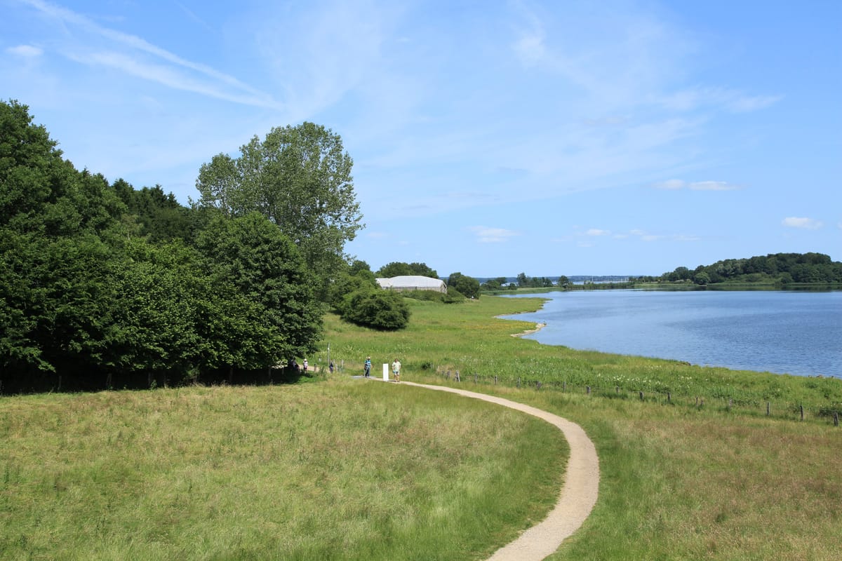
Image credit: Frank Vincentz (CC BY-SA 3.0), via Wikimedia Commons
From 808 to UNESCO: A Line Reused Across the Centuries
- 8th century. The oldest phases of the main wall go up, dated by tree rings to well before the first written mention.
- 808. The Royal Frankish Annals record King Godfred fortifying the Saxon frontier with a single gate.
- Late 10th century. The main wall is tied into the semicircular rampart at Hedeby, in the reign of Harald Bluetooth.
- 12th century. Valdemar’s Wall is raised in fired brick along the main rampart.
- February 1864. The Danish army abandons the position without a fight in the Second Schleswig War.
- 1930s. Large excavations under Herbert Jankuhn, embedded in the research apparatus of the SS.
- 2010. The state archaeology service of Schleswig-Holstein locates a gate through the main wall.
- 2018. The Danevirke and Hedeby are inscribed together on the UNESCO World Heritage list.
The 1864 entry deserves a moment. In the Second Schleswig War the Danevirke stood in Denmark as the national bulwark, loaded with every meaning a symbol can carry, and the army had reinforced the old line with modern redoubts. On the night of 5 to 6 February the command under General de Meza abandoned it without a fight, because the line was too long, the force too small, and the frozen waterways made it far too easy to walk around. Militarily the decision was probably sound. Publicly it was a disaster: the retreat caused a national shock, and de Meza lost his command over it. By then the wall was obsolete, yet so freighted with meaning that giving it up read as betrayal. Later research carries its own political weight. The 1930s campaigns produced material still being worked through today and stand as a case study in how archaeology can be pressed into the service of an ideology.
Conclusion: A Border You Can Walk Along
The Danevirke is a difficult monument because it shows so little. No towers, no gatehouse, no silhouette. Visitors get grass, a slope and a stretch of exposed brickwork. And yet it is among the most informative sites in the North, because for a thousand years it kept answering the same question: where does one thing end and another begin.
Generation after generation, rulers poured labour, timber, eventually brick and repeatedly political will into the same line. They did it not because a rampart is unbeatable, but because it imposes order: one road, one gate, one check, one payment. Once that clicks, the grassy ridge near Dannewerk stops being a fold in a field and becomes what it is, a border heaped up out of soil and remarkably hard to get rid of.
Cover image credit: Matthias Süßen (CC BY-SA 4.0), via Wikimedia Commons