Warriors & Battles
The Viking Ring Fortresses: Precision From the North
Trelleborg and the Viking ring fortresses: exact circles, four gates, Harald Bluetooth, and the still unsettled argument about what these sites were really for.

Contents
- A Circle You Can Actually Measure
- Five Sites, One Blueprint
- Harald Bluetooth: Building a Ring Fortress Like Trelleborg Means You Already Rule
- What Were They For? An Honest Disagreement
- What the Building Work Presupposes: Surveying, Command, Timber
- Timeline: Construction, Abandonment, Rediscovery
- Conclusion: The Circle as a Political Argument
Stand on the rampart at Trelleborg near Slagelse and something feels off within about thirty seconds. A Viking ring fortress is not a place that grew. It is not a farm that spread out over generations, not a bank thrown up wherever the slope happened to help. The circle is a real circle. The four gates sit on the cardinal points. Two roads run between them, cross at the centre, and quarter the interior, and inside each quarter the longhouses stand in a square around a small yard. What survives here is not a wall or a house. It is an idea about order, worked out in advance and then imposed on a landscape that had no say in the matter.
A Circle You Can Actually Measure
The ground plan of the Danish ring fortresses can be summed up in a sentence, which is exactly why it is so startling. A precisely circular earthen rampart encloses the site. Four gateways pierce it, aligned to the compass points. Streets link the opposing gates, meet in the middle, and divide the interior into four equal quadrants. Each quadrant holds longhouses set in a square. That is the whole design, and no part of it is left to chance. No row of buildings bends to accommodate the ground.
That sounds unremarkable until you set it against everything else we know about settlement in the period. Viking Age sites usually negotiate with their surroundings. They follow water, avoid wet ground, cluster where the neighbours already are. A farm expands, a market frays at the edges. Here the logic runs the other way: the plan exists first, and the terrain has to accept it. The same plan turns up at site after site, across different islands and different regions, in landscapes that have very little in common. Repeating an identical circle in several places is not the behaviour of a local building tradition. It is the behaviour of an instruction.
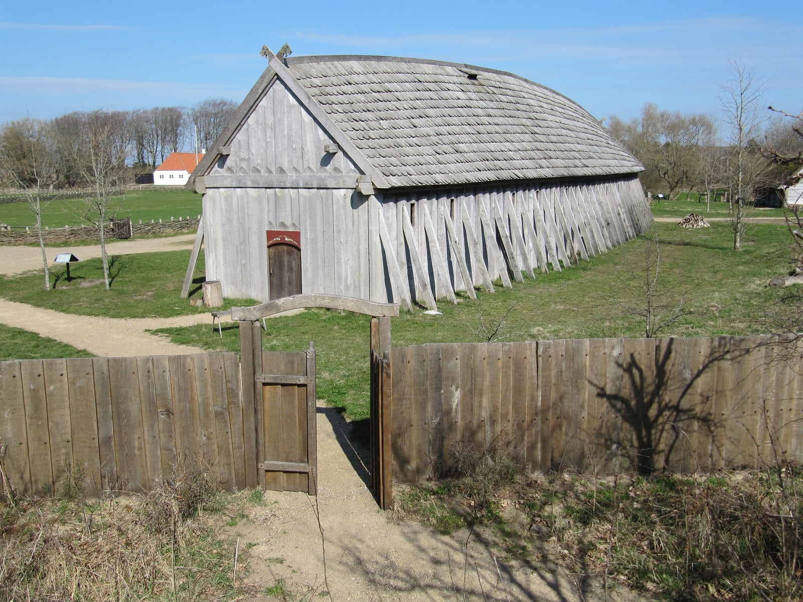
The buildings are standardised too. They are long structures with gently bowed long walls, distinctive enough that archaeologists simply named the type after the site: the Trelleborg house. Outside the rampart at some of the sites, further house plans and burial grounds have been recorded, which is a useful corrective to the tidy aerial photographs. The circle was not the whole community. People lived around the fortress who belonged to it without living inside it.

Image credit: Flickr user: Heini Samuelsen Malmoe, Sweden (CC BY-SA 2.0), via Wikimedia Commons
Five Sites, One Blueprint
The group known collectively as the trelleborgs is spread across the Danish landscape. The individual sites differ enormously in scale and in how much of them survives, but all of them follow the same geometry. The table below sets them side by side:
| Site | Region / Setting | Distinguishing feature |
|---|---|---|
| Trelleborg | Zealand, near Slagelse | Gave the whole group its name; excavated early and extensively, with house plans recorded outside the rampart as well |
| Borgring | Zealand | The most recent addition, only identified as a fortress of this type in the 21st century |
| Nonnebakken | Funen, at Odense | Lies within the modern town and is largely built over, so only partly accessible |
| Fyrkat | Jutland | Well investigated; dendrochronological dates from here underpin the dating of the group |
| Aggersborg | Jutland, on the Limfjord | By some distance the largest of the sites, placed on a strategically central waterway |
Borgring deserves a moment on its own. The fact that another site of this type could still be recognised in the 21st century tells you two things at once. First, a thousand years of ploughing can flatten a monument until the naked eye no longer registers it. Second, modern survey methods, from careful mapping of surface relief to geophysical readings taken through the soil, can recover structures that generations of walkers strolled straight across without noticing. It would be rash to assume the list is closed.
Aggersborg on the Limfjord is the outlier, simply because it dwarfs the others. In the Viking Age the Limfjord was one of the most important water connections in the Danish world, a route westward where controlling the passage translated directly into the ability to act. Whoever chose to put the largest site of the entire group there was not thinking locally.
Harald Bluetooth: Building a Ring Fortress Like Trelleborg Means You Already Rule
The fortresses are conventionally attributed to Harald Bluetooth and placed in the second half of the 10th century. That is more than a comfortable assumption. Dendrochronological dates are available from Fyrkat and Trelleborg, meaning dates read from the growth rings of the timber that was actually built into them. Under favourable conditions the method is remarkably exact, because it works from the growth pattern of individual trees rather than from a statistical range. Those results support placing the fortresses in Harald’s decades.
And this particular king left behind a monument that can still be read directly. The great runestone at Jelling names Harald as the man who brought Denmark under his rule and made the Danes Christian. It is one of the rare occasions in the Viking Age where a ruler states his own claim in his own words, rather than having a later chronicler state it for him. The stones themselves are covered in our article on the Jelling stones.
The fortresses and the runestone belong together, even though one is earth and timber and the other is granite. Both are statements from the same sender about the same subject: someone is in charge here, and no longer only of his own kin. The stone says it in runes. The fortresses say it in geometry.
Something to listen to while walking the ramparts, drawn from the same world:
What Were They For? An Honest Disagreement
Here is the part where serious scholarship does not agree, and that is the most interesting thing about the whole subject rather than an embarrassment. We know a great deal about what these places looked like and remarkably little about why they were built.
The classic reading, the one that dominated popular accounts for decades, was blunt: Viking barracks. Training grounds and mustering camps for the armies that sailed from here to England. It is a seductive picture, because it short-circuits the disciplined ground plan into military drill, and because it falls in a period when Scandinavian fleets really were moving west in force. Today that explanation is considered too narrow. It does not account for why the sites are distributed across the country rather than concentrated at the ports of departure, and it quietly ignores the finds that look a good deal more like ordinary life, craft work and storage than like a pure military camp.
Several functions are now discussed, and they do not exclude one another:
- Mustering points for troops and fleet operations. Somewhere to gather men and equipment into order before they board. This reading is not wrong. It is simply not the entire answer.
- A display of power and a grip on the interior. A fortress built like this is not aimed only at an enemy from outside. It sits visibly in a landscape and informs the local magnates whose voice now carries.
- Administrative and taxation centres. Bases where dues were collected, disputes settled and goods handled. A kingdom in the process of forming needs physical points where it becomes tangible.
What strikes our editorial team is how often the debate is conducted as if one answer had to win. Why should it? A centrally planned stronghold can gather troops, collect dues and impress the neighbours all at once. Fortresses in later centuries did precisely that as a matter of routine. What separates these sites from later seats of power is not their purpose but the fact that, this early, they were planned this rigorously.
What the Building Work Presupposes: Surveying, Command, Timber
The real find at these sites is not the rampart. It is what has to stand behind a rampart like that. An exact circle with four correctly oriented gates does not appear because a rural community decides one spring to attempt something ambitious. It requires three things that rarely come together.
First, surveying: the ability to set out a circle, lay axes at right angles and fix the cardinal directions reliably. Second, command over labour: earth does not move itself, and the people shifting it are not in their own fields while they do it. Somebody has to be able to assign them, and somebody has to feed them for as long as the digging lasts. Third, access to timber, in quantities that are genuinely hard to picture. Timber-laced ramparts, palisades, gate structures and whole ranks of large longhouses are not a woodpile. They are a standing forest that somebody has the authority to fell.
This is why the fortresses are evidence in a much bigger argument, the one about the emergence of a Danish kingdom with recognisably state-like features. A leader who distributes plunder is nothing unusual in this world. The lord as ring-giver is one of the most durable images in Norse and Old English verse; in Beowulf, the king is a king precisely because he hands out rings. But a ruler who coordinates labour, raw material and surveying knowledge at several places at once, over years, is doing something a generous ring-giver never had to do.

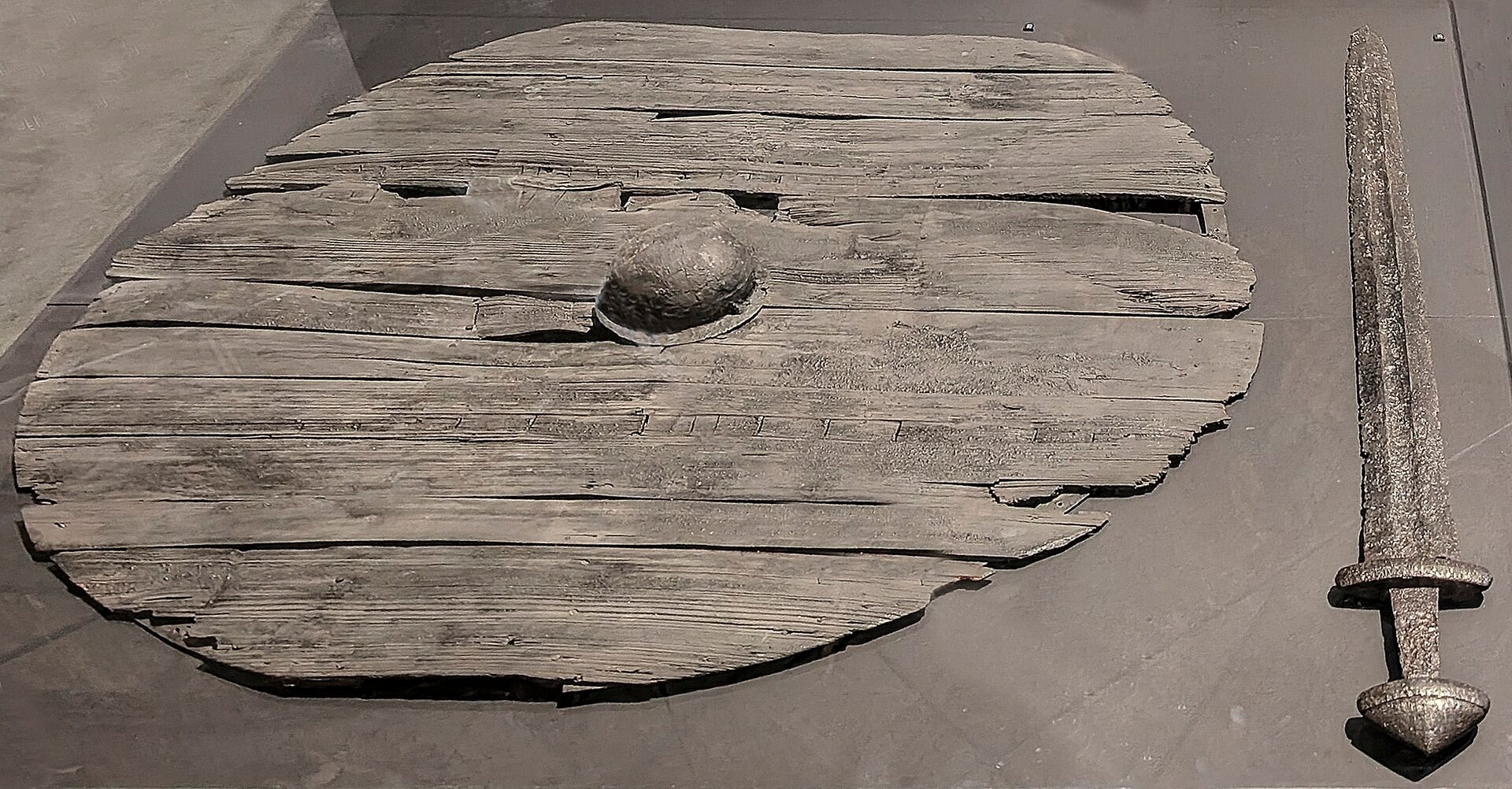
Image credit: Wikimedia Commons (CC BY-SA 3.0), via Wikimedia Commons
Scepticism is warranted in both directions here. It would be an overreach to inflate the ring fortresses into proof of a finished administrative state, which is still a long way off. But it would be just as wrong to treat the planning as incidental. The planning is the finding. And the fact that the sites were apparently in use only for a relatively short time makes the whole thing stranger still: someone builds a system at enormous cost and then lets it go. Whether that reflects a change of ruler, a change of priorities, or an instrument that had already done its job, we cannot say. The great flows of English silver that later reached the Danish kings belong more to the following generation; how those payments worked is the subject of our article on Danegeld.
Timeline: Construction, Abandonment, Rediscovery
The story of these fortresses can be told in a handful of stages, and each one says something different about how they were treated.
- Construction under Harald Bluetooth. In the second half of the 10th century the sites are laid out to a single shared plan, a dating supported by dendrochronological results from Fyrkat and Trelleborg.
- A short working life. The fortresses appear to have been in use for only a relatively brief period. They lack the thick accumulated layers and repeated rebuilding typical of long-lived settlements.
- Abandonment. Operations end without any single cause being securely identifiable. The ramparts slump, and the ground returns to farming.
- Rediscovery and excavation. In the 20th century the sites are investigated archaeologically, and only then does the shared blueprint become visible as such. The collective term trelleborgs takes hold for the whole group.
- Borgring, the newest member. In the 21st century Borgring is added to the family, identified with modern survey techniques rather than by chance.
- World Heritage. In recent years the Danish ring fortresses were inscribed as a joint World Heritage property, placing them in the same frame as Jelling, the other great site of the Danish Viking Age.
Conclusion: The Circle as a Political Argument
These are, frankly, poor ruins. No towers, no standing masonry, no photogenic window arches. What you get is a bank of earth and a lot of grass. And yet Trelleborg is among the most informative places of the entire Viking Age, because for once what lies in the ground is not a single spectacular object but an act of organisation.
The purpose can be argued about, and it should be. Barracks, administrative seat, statement of power: the evidence does not permit a clean verdict, and any answer delivered with too much confidence deserves suspicion. What cannot be argued away is the precision. Someone knew how to set out a circle, persuaded people to dig it, and carried that through at several places at the same time. In a period we love to narrate through raids and individual heroes, that is the genuinely remarkable part. Not the axe in the hand, but the measuring line in the ground. The ring fortresses are the moment when a following turns into an administration, and a Danish kingdom appears that had suddenly learned how to plan.